
Mehrshad Nourani
ESRI GIS Federal User Conference 2014, Washington D.C.
U.S. Census Bureau, Demographic Survey Division
Process and Data Automation Made Easy – Mapping Automation with Python and ArcGIS (10.1) ModelBuilder
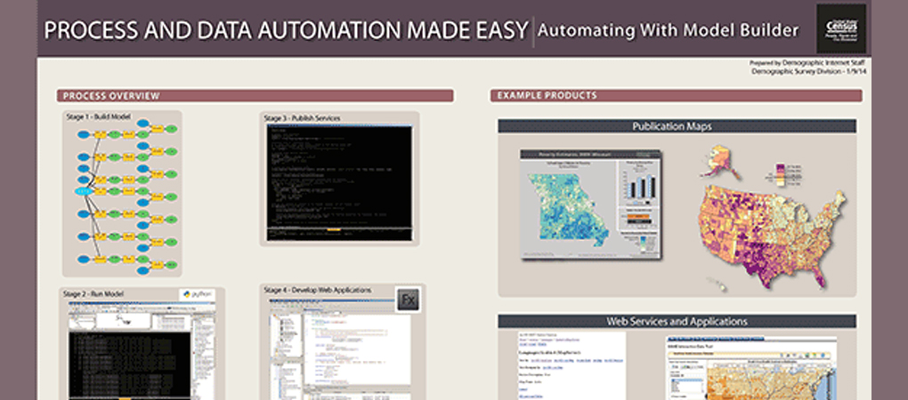
The Census Bureau produces, stores, and disseminates vast amount of data for public use. Increasing amounts of these data are provided through GIS systems and published for public consumption via the Internet utilizing web APIs that are used to develop applications. Automating our geoprocessing workflow improves productivity, efficiency, and accuracy of routine GIS tasks. Examples used in this poster, the Small Area Health Insurance Estimates (SAHIE) project, includes several time-consuming geoprocessing tasks such as data extraction and conversion, data quality review, feature class editing, and more before it can be consumed by the public.
In this model, the automation allows an analyst to start a series of processes by running a Python/ArcPy scripts from the desktop environment. Because these projects repeat annually to reflect changes in data, the process can become quite repetitive and time-consuming if not automated. Prior to automation, the overall geoprocessing sequence involved discrete steps to be performed repeatedly and on several datasets. The need to iterate a process prompted the need to devise a new approach and use Python scripting to provide utility functions such as data extraction and preparation, data and feature class edits, data indexing, data joining, and map service definition creation and publication. Prior to automation, iteration of the processes took several days. Now, the model can complete the process in hours instead of days.